The mechanistic models included in the IRMDSS framework include:
Reservoir Model
A reservoir model is a computer model that is used to simulate the reservoir pressure, fluid flow, and other flow properties within the reservoir based on the geological conditions (natural containment features), engineered components (man-made features), and operational activities. The construction of a reservoir model is based on existing data but the goal of reservoir modeling is to be able to predict reservoir conditions in the future.
The software used in this project for the reservoir model is iTOUGH2, which provides inverse capabilities for the TOUGH simulator, a non-isothermal multiphase and multicomponent numerical simulator developed the Lawrence Berkeley National Laboratory.
Geomechanical Model
A geomechanical model is a computer model that is used to simulate the stress and deformation in the reservoir and overburden due to activities within or above the reservoir (e.g., gas injection or withdrawal in this project). The deformation will lead to porosity and permeability changes, which may affect reservoir performance (fluid flow).
The software used in this project for geomechanical modeling is TOUGH-FLAC, which is a coupling of TOUGH and FLAC3D. FLAC3D is a commercial numerical modeling software for geotechnical analyses of soil, rock, groundwater, structures, and ground support.
Wellbore Model
A wellbore model is a computer model that is used to predict pressure and temperature response patterns under normal and/or abnormal (leaking) flow conditions within wellbores.
In this project, T2Well (Pan and Oldenburg, 2014), a wellbore model developed at the Lawrence Berkeley National Laboratory, is used for simulating wellbore flow processes. The model can be used to evaluate the effectiveness of possible safety measures and wellbore configurations (e.g., down hole safety valve, flooding annulus with water and proper tubing size, etc.) and design optimal injection and withdrawal operations. In addition it can simulate various pressure control procedures (aka well kills) for leaking wells and identify optimal kill procedures for each type of well configuration and gas storage system to minimize the impacts of well failure.
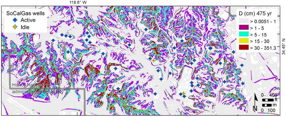
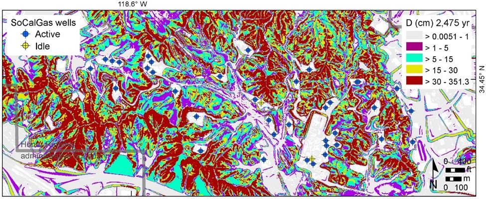
Geo-hazard Analysis
Geo-hazard in this framework includes seismic, fault displacement and earthquake-induced landslide hazard. As a demonstration, a long-term probabilistic geo-hazard analysis method is developed for the Honor Rancho site.

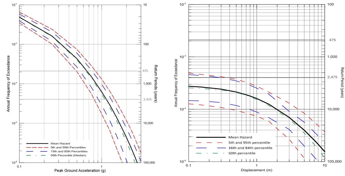
Figure 5b: Fault displacement hazard curve for San Gabriel fault. For demonstration of PFDHA, it was assumed that the San Gabriel fault intersected well WEZU-7 (API 03710667) at -118.580361, 34.448127.
* * * * * * * * * *
Please contact Helen Prieto, HGPrieto@LBL.gov, for questions, comments or suggestions related to this website.